“It’s just a gradual climb”
John suggested, as we four headed away from Siberia Hut in the Siberia Valley with Mt Dreadful offering up it’s foreboding flanks as guidance, towards Gillespies Pass.
GRADUAL:
adjective
1.
taking place or progressing slowly or by degrees.
"the gradual introduction of new methods"
2.
(of a slope) not steep or abrupt.


The previous day we had helicoptered in to siberia hut,
dropped our packs heavy with all manner of extravagances (as one does when being heli’d in) and headed for Crucible Lake.
Siberia Hut is in the remote Siberia Valley in Mt Aspiring National Park, and is a Te Waihepounamu UNESCO World Heritage site, in the Southern part of the great Southern Alps. It is one of the three main valleys that make up the Gillespies Pass Circuit, a usually three to four day walk comprising approximately 58 km.
The name “Siberia” alone, conjures up images for me of suffering, cold, misery and raw aloneness. With surrounding mountains claiming names such as “Mt Achilles”, “Mt Awful” and “Mt Dreadful”, one cannot help but know that some semblance of suffering will be on the cards!
The weather for Easter weekend was not forecast to be the best. I had to wonder, if I had been solo tramping, might I have ditched the adventure and opted for a soft option instead? It was my first trip to the famed Gillespies Pass circuit and I had heard it was a challenging circuit with a killer descent from the pass into the Young valley.
I found myself obsessing over my ability to make it down the steep descent to the valley floor!
Meanwhile, Crucible Lake was first on the tick list, and John assured me the walk to it, was just a ‘gradual climb’.
I was to hear that phrase again the next day, as we ascended the pass track itself.
Lies.

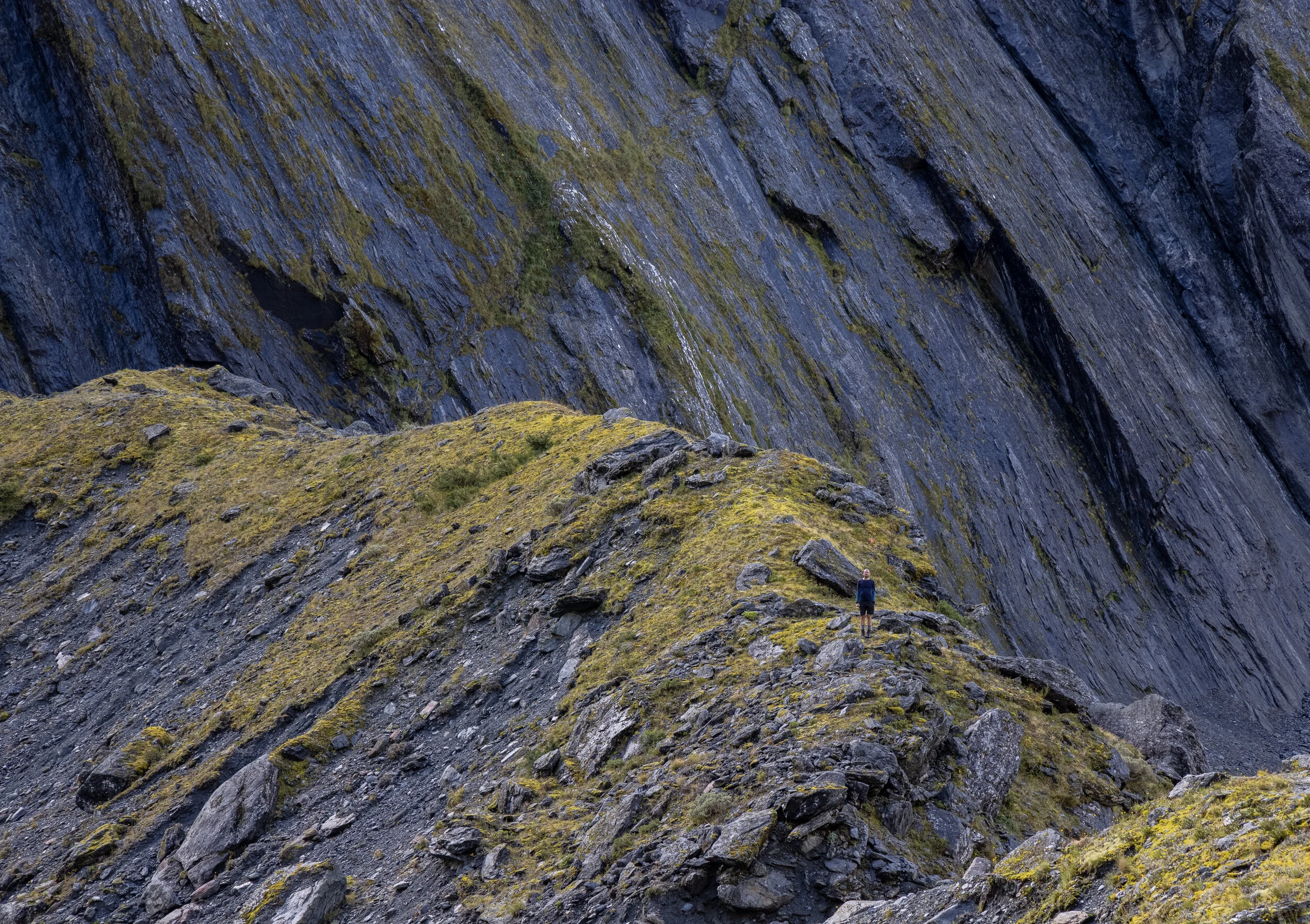
The moraine wall guarding Crucible Lake. The wall is deceptively high,.
It is a 542m elevation gain in 6.7 km (one way), from Siberia Hut to Crucible Lake,
with the majority of that elevation gained from the beginning of the Crucible Lake track up to the lake itself.
This section is around 3 km long and takes you up a narrow forested valley which leads to the incredibly grand lake basin, sitting like a crucible below the formidable Mt Alba.
A large moraine wall guards the lake and offers one last final push, after a pleasant wander through the open gentler terrain, once leaving the bush track.
As i walked behind the three guys I had come away with, slowly ascending the track to Crucible Lake,
I took a reality check as to why I was engaged in my own personal suffer-fest (yet again), and realised that at 55 and unfit, I could not hope to keep up with the whipper-snappers I was hiking with. I settled into my own rhythm, climbing onwards and upwards, delighting in the occasional views of a raging stream to one side, and glimpses of angry mountains across the valley.
Titipounamu (Rifleman) and Piwakawaka (Fantail) flirted with me under the protection of the track canopy, but proved impossible to capture with my camera due to dim light, and once at the lake edge, Pihoihoi (Pipit) made an appearance, seemingly delighting in the possibility of tit-bits left by humans.

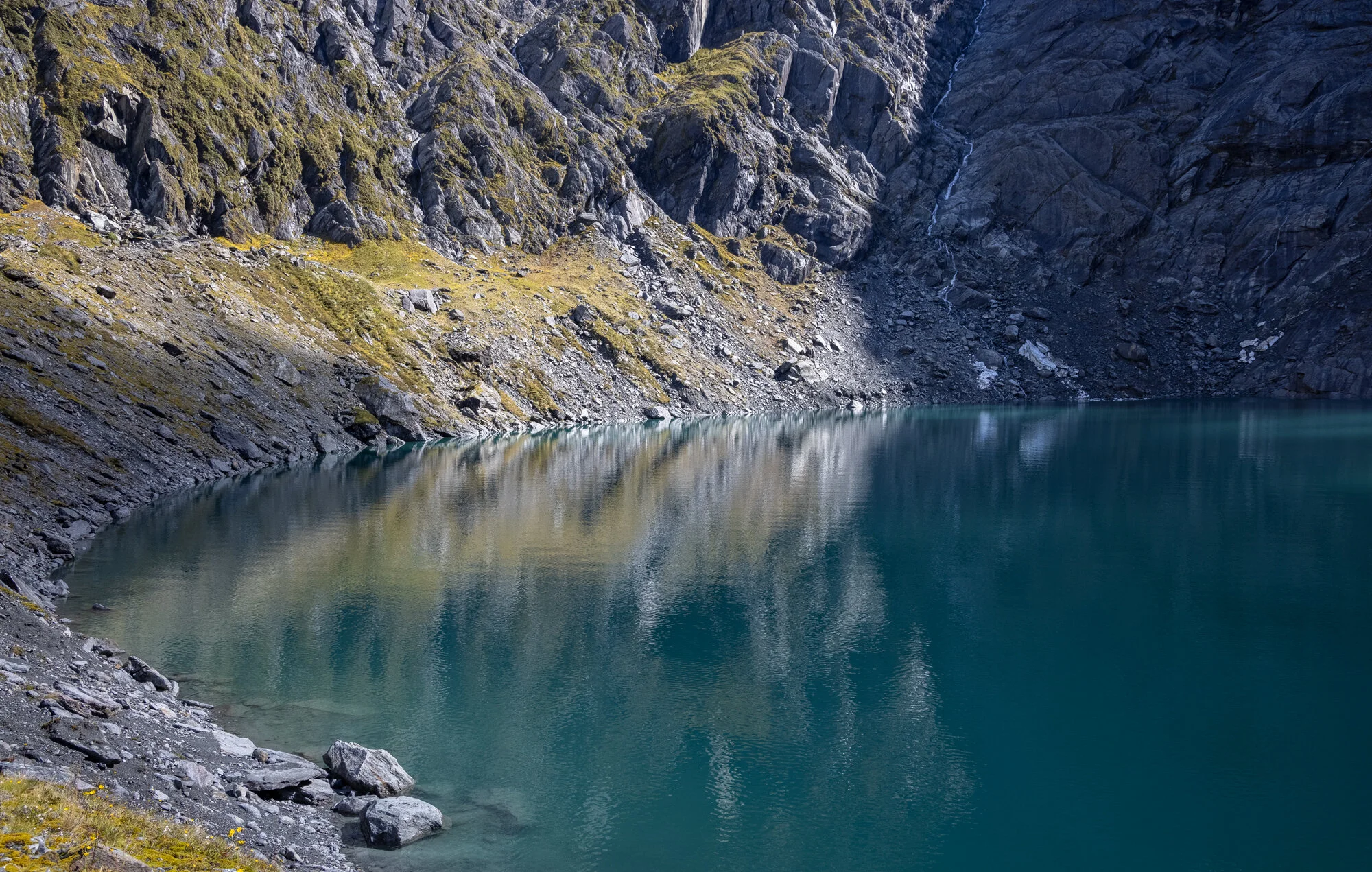

Sheer rock walls with stratification at the most impossible of angles, drop away into this stunningly beautiful alpine lake which is often littered with icebergs. On this day, ice remnants were scattered about the far end of the lake and the luminescent aquamarine water belied the pleasant temperatures we were exposed to whilst there. One of my tramping buddies decided a swim was warranted and he braved the icy waters for a very brief breath-taking moment.
Needless to say he was not in there long.
Siberia Hut sits at about 640m elevation
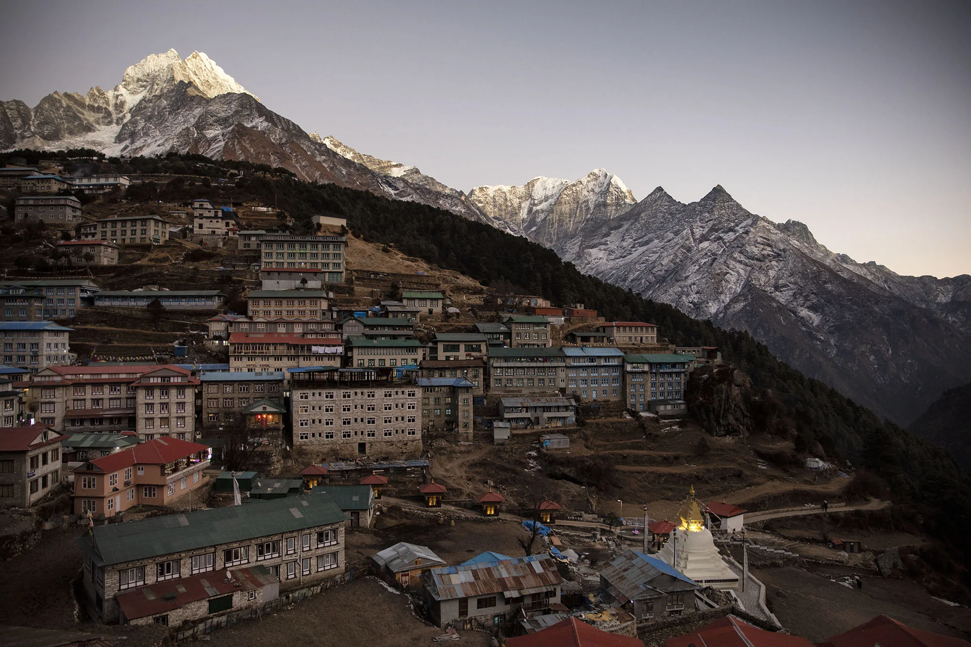
and is near an airstrip which offers people the ability to fly in-fly out with a Crucible Lake day walk option. We three opted to helicopter in due to inclement weather temporarily halting plane flights. The valley is not wide and is surrounded by mountains, so the approach needs to be made in clear weather. A helicopter offers more flexibility in that it has the capability to fly safely at lower altitudes and does not need a large area for landing. We flew in with Wilkin River Jets and Back Country Helicopters for a very reasonable price, which saved us a long slog up the valley from Makarora and allowed us to make the Crucible Lake hike in the same day. It also meant we could bring in luxuries such as bottles of wine and other heavier food items we would not have otherwise tramped in due to weight.
The flight in alone was one high-lights of the trip for me, as the view above enormous waterfalls cascading down mountain-sides, was simply amazing.

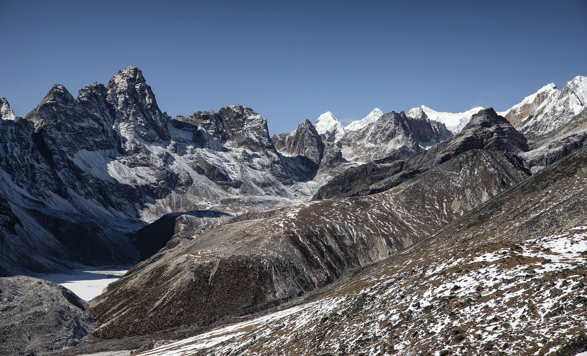
Mt Dreadful is the dominating feature of the Siberia valley head
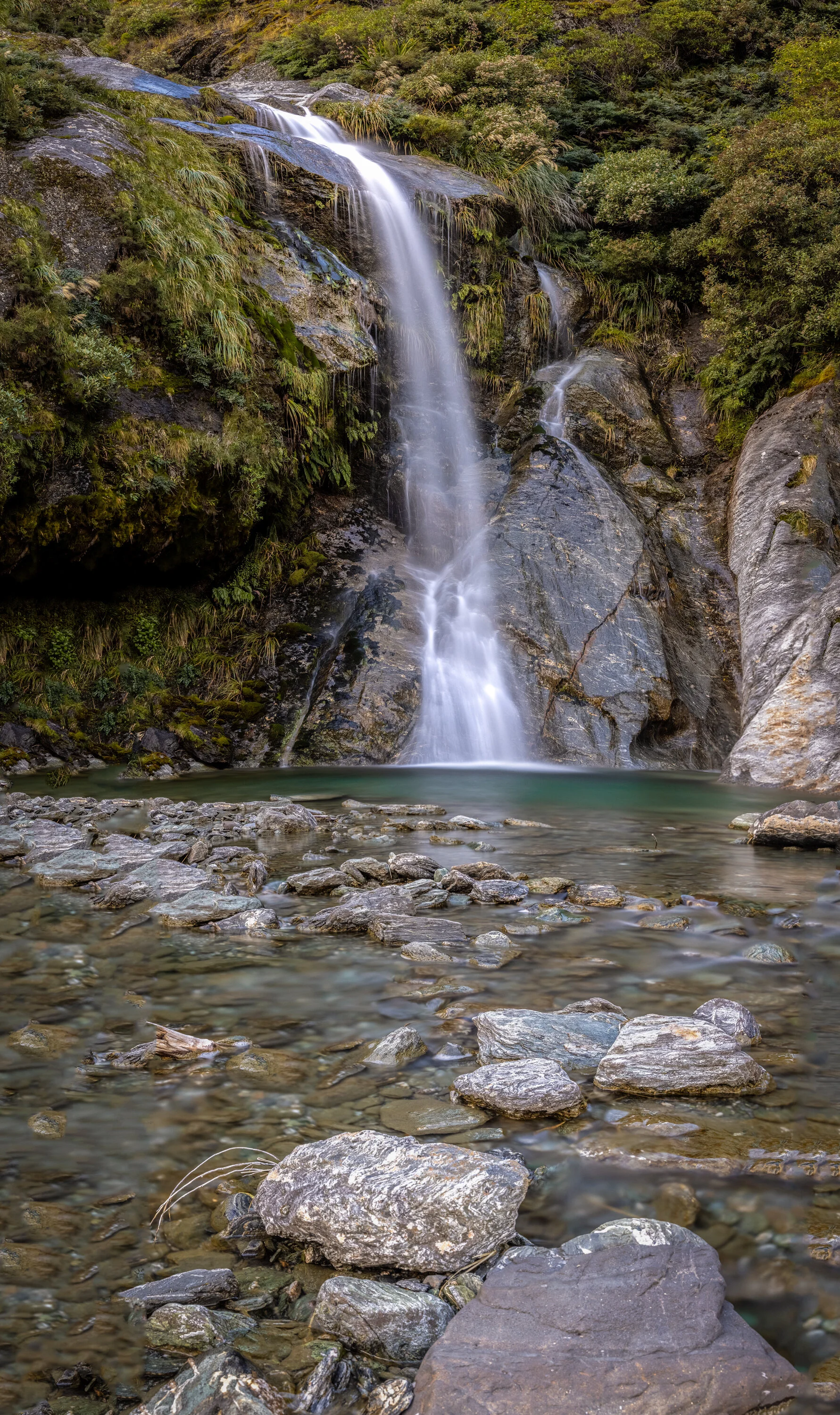
and can be viewed from the front deck of Siberia Hut. With the Crucible Lake side-trip done and dusted, the goal on day two, was to ascend Gillespies Pass, descend into the Young Valley and spend the night at Young Hut. This section of the track would take us to 1630m elevation on the pass and involve a steep descent - the one I was dreading. The walk from Siberia Hut to the pass track turn-off is a hardly noticeable very gradual climb (not John ‘gradual’, but actual gradual!) and passes several large waterfalls. There is also a stunning waterfall right by Siberia Hut which would make a pleasant swimming spot in summer. I have heard though, that the sandflies are pretty rife at that time of the year!


The climb up to gillespies pass
takes you up (a ‘gradual’ climb - yeah nah), through stunning bush and eventually onto open tussock areas which are very exposed to the elements. The track sidles through rocky outcrops and eventually brings you to the pass itself which provides the most incredibly drop-dead mind-blowing views of the wall that is Mt Awful (2192m) and the dramatic landscape around it, as well as evocative views into the Young Basin. You can literally smell the geological history of this area; evident through vast slabs of rock that make up the interesting shapes of the surrounding landscape. It was hard not to feel dwarfed, when standing on the pass and looking towards the imposing structure of Mt Awful, as well as the mountains making up the far side of Young Valley.
It was almost LOTR-esque.


The 600m+ steep descent into Young valley
took us quickly onto the easy route leading down to Young Hut. The descent is peppered with the infamous ‘Spaniard’ or Speargrass/ Taramea and in places is a temptation to grasp onto when the descent forces you to gather momentum! You quickly learn, however, that this stuff is not to be taken lightly, as it can pack a mean stab and easily draw blood. I guess thats why it earned its nickname of ‘Spaniard’!
The track follows the Young River (south branch) and is a very pleasant and much appreciated walk after the taxing amount of uphill to the pass. The hut sits at 550m and is on a ‘first in gets a bunk’ basis, whereas Siberia requires a hut booking. I found it a cold hut; hard to warm even with a fire (we had damp wood), as it sits in a shady area. The reward at this hut however, was the persistent and flighty Titipounamu who were on the hunt for bugs living in the window frames. They treated us to regular visits, dancing around, oblivious to our presence. Titipounamu (Rifleman) is a stumpy little bird and is generally considered to be New Zealand’s smallest bird, being part of the endemic Wren family. I had hoped to see Pīwauwau (Rock Wren) whilst on the circuit, but so far this had eluded me!
Young Hut was an interesting experience - where we had the loudest snorer I have ever heard, in the hut that night. He had arrived late but was one of the first to go to bed - asleep and snoring voluminously within minutes. A group of young trampers who were in the same bunk room as this trombone-like snorer, quickly realised what they were in for, and gathered in the eating area to discuss options. Some of them considered sleeping in the eating area; others had earplugs. I always bring earplugs as I find the experience of sharing a bunk room with numerous others, always keeps me awake. Even with earplugs in, and sleeping in a different bunk room, I could hear this mans snorting, wheezing, snuffling, clangorous symphony of sounds reverberating throughout the hut and into the night. I am sure that if such a thing as a boogey-man existed, it would have stayed well clear that night!.
Our final day on this superlative circuit
would take us from Young Hut, down along the Young River, to the Makarora River, via Young Forks, where the South Branch and North branches of the Young River converge. This section was approximately 20 km long and would involve a river crossing if conditions were right, or an additional three hours alongside the Makarora River to the Blue Pools carpark. This was not our preferred option, as it would also mean a long tedious walk on the state highway back to Makarora township, to where our vehicles were parked.

Image: Wikipedia
We walked in drizzle and sometimes in heavier rain, anxious to reach the river crossing point before the river levels rose.
The section from Young Hut is mostly through bush heavy with Silver Beech/Tawhai. It is studded with views to the Young River and in places some spectacular river cascades and views across to lengthy waterfalls tumbling from the valley walls above. There is also a picturesque swing bridge crossing at the North Branch intersection - Young Forks - which would make an ideal place to pitch a tent.


The Mighty makarora river was a welcome sight
and we all agreed that a crossing was on the cards to avoid the extra three hour walk to Blue Pools.
We locked into each other and crossed the river together, reaching the farm paddocks that ran alongside the main road into Wanaka. The river crossing here is wide, as the Makarora is a braided river system. It can, at times, have pools of deep swift water and should always be crossed with care and respect. The final section from the farm paddocks, I found to be completely tedious and I was not looking forward to the several kilometer jaunt along the main highway back to the car! Lucky for us, a driver pulled over and took one of our party to collect the car and then come and collect us to avoid any further walking. Isn’t it amazing how the brain says ‘enough!”

advice for old girls like me wishing to complete this circuit:
Get used to carrying a pack with weight in it, prior to embarking on a multi-day hike, and get some miles under your belt first
Take ear plugs
Ensure your boots are worn in
Carry water for the pass - there are streams on the way up but after leaving the bush, there is no more water (this is Siberia Hut - Young Hut direction)
Use walking poles if you feel unsteady on steep descents (I personally hate them, but I can see they would be useful in this terrain)
Know how to safely cross a river if contemplating exiting at the Makaroa
Fly into Siberia if time is short!
Take strapping tape - always handy
Take toilet paper
Ensure you have a good headlamp
Wear layers not bulk. Merino is perfect
Take a good quality rain-proof jacket
Pack a beanie
Carry a PLB
Camera! Too flippin’ mind-blowing not to capture it!
There are plenty of other must-do’s for tramping in an alpine area such as this and there is a lot of information online which can help with basics such as how to pack your pack, using gas stoves, info about dehydrated food v fresh food, shoes, clothing, river crossing, descending safely downhill and so on. Have fun!