• About
  • Work
  • Blog
  • Contact
Menu

Little Leaf Photography

Creative Photography and Design
  • About
  • Work
  • Blog
  • Contact

B l o g

Welcome to my blog page.

Please click “older posts” which will jump-start you to the bottom of the page, to find all previous posts.

Enjoy!

kid.jpg

Folding Upwards Part Two: Lukla to Phakding

January 20, 2019

The trail towards Namche from Lukla, is well worn.

At 2860m above sea level, Lukla is the main starting point for treks heading into Sagarmatha National Park, and is also the starting point for lesser traveled treks into the Makalu Barun National Park, which includes Meru Peak and Makalu. This part could also join to the main Everest trekking routes via the Island Peak trek at the end of the Chhukhung Valley, making a very long circuit for the those who have the time for more wandering.

After shunning the advances of eager porters, I found the track to my destination for the night - Phakding - and strode off with lofty confidence; my pack embracing me from behind as if to say “your’ve got this, girl”.

The walk from Lukla to Phakding, although very up and down, trends downward, finishing at an elevation some 200m lower than Lukla. The trail largely follows a milky aquamarine river (Dudh Kosi) through the valley floor and passes through quaint villages with tea houses and shops selling trekking provisions. Even though this was the end of the season, there was still an air of ‘business to be done’.

river.jpg

It was early in the day when I started walking.

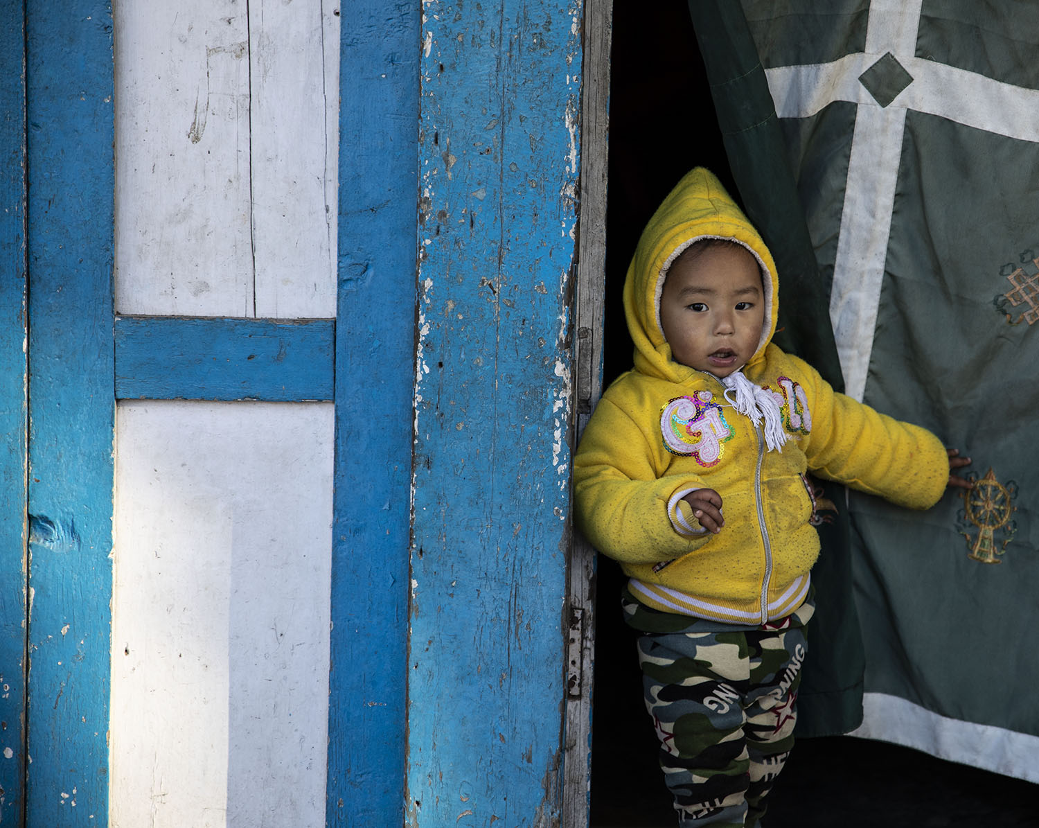
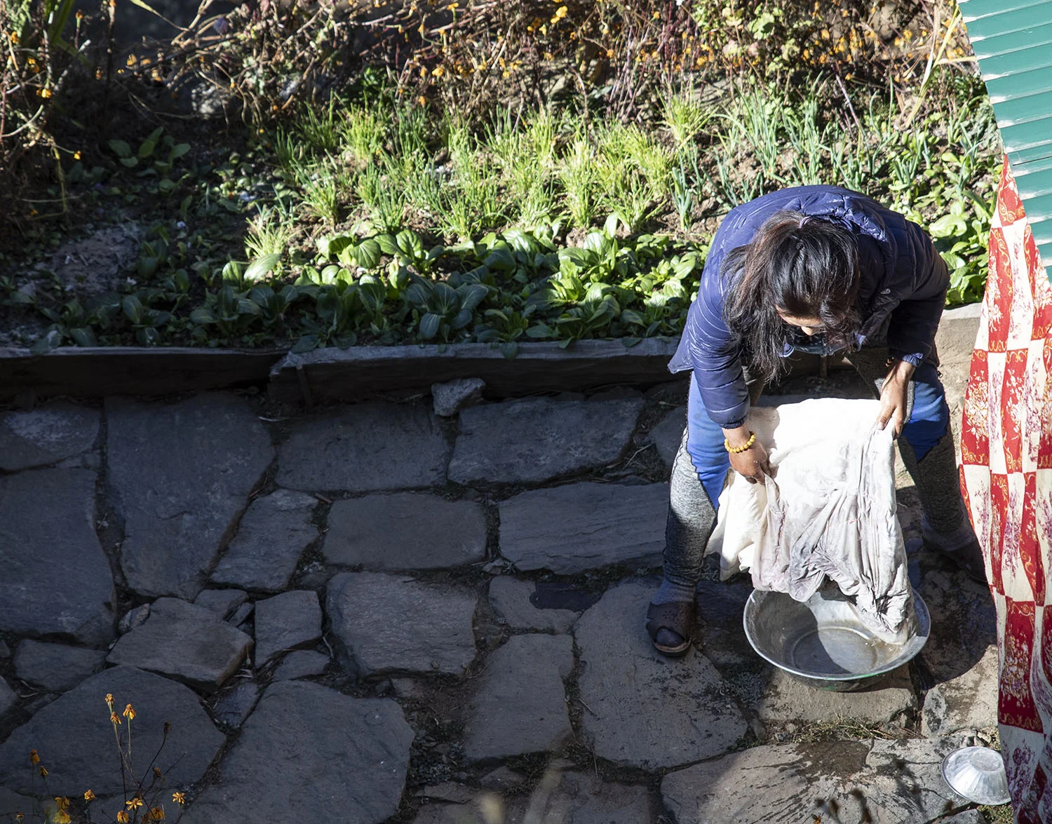
Women were outside their homes engaged in the days tasks - washing clothes, preparing vegetables, washing children’s hair, tending to goats. The sky was a deep blue and occasionally I would catch a glimpse of a snow-clad peak. There was a noticeable absence of noise - just the sound of children laughing, the river flowing, birds singing …

washing.jpg

Walking the trail into Phakding is akin to walking a main highway in New Zealand. The trails are the only way supplies can be delivered to villages higher up; everything travels by human or donkey power. Yaks are seen at higher elevations. I saw people carrying the most insane loads and also learned very quickly to stay to the mountain-side of the trail whenever a long line of donkeys came through - kicking up dust, with their ‘driver’ cracking the whip on foot behind, whistling and vocalising their instructions which only the donkeys could understand. Whilst the majority of supplies come in via the trail, helicopters are increasingly being used as well, particularly beyond Namche.

A man, singing away loudly to himself, carries a huge load down towards Lukla.

A man, singing away loudly to himself, carries a huge load down towards Lukla.

A heavily laden donkey seems to know the way to go.

A heavily laden donkey seems to know the way to go.

tunnel.jpg

The trail kept me engaged and acutely aware of my surroundings.

My senses felt as if they were on hyperdrive; I was over-whelmed by the colours, smells and sheer beauty of the trail. It was a humbling experience to know that before me, many incredible people had walked this same way - Sir Ed, Rob Hall, George Mallory … what a path to walk along. I am certain though, that Sir Ed did not have the luxury of using modern wire suspension bridges to negotiate river crossings! These bridges, suspended high above the rivers, look intimidating, but are such an integral part of successful transportation for the mountainous regions, that life without them would be far more arduous.

Suspension bridges always have Buddhist prayer flags on them, as a way of ensuring safe passage across the river.

Suspension bridges always have Buddhist prayer flags on them, as a way of ensuring safe passage across the river.

It was hard to believe I had lost 200m in elevation, when I walked, tired, into Phakding village, less than three hours after leaving Lukla.

I felt as if I had been walking uphill since leaving Lukla, but the reality was:

Starting elevation: 9,383 ft / 2,860 m

  • Ending elevation: 8,563 ft / 2,610 m

  • Starting oxygen: 72% of sea level

  • Ending oxygen: 74% of sea level

  • Distance covered: 7.5 km

  • Time hiked: 2h 40m

phakding1.jpg

In New Zealand, a 7.5 km walk is one that I would be able to easily and quickly do, in a short period of time, without breaking into too much of a sweat.

In Nepal, this same distance at a higher elevation, means everything slows right down. I was not feeling the reduction of oxygen in terms of my breathing, but my body was telling me there was less available for my muscles to use - I walked slowly considering I was going to a lower elevation. I was relieved to see the teahouse was still open that I had researched before leaving New Zealand - it was two years old and looked comfortable. I knew as I got higher into the mountains, that comfort would cease to be!

A new clean sleeping lodge is behind the main teahouse.

A new clean sleeping lodge is behind the main teahouse.

The ‘Sherpa Guide Lodge’

was clean, warm and cheap. I paid extra to have my own bathroom (NZ $12), but a room with no bathroom was only 400 rupee ($5 NZ). The shared bathroom facilities were clean and also had warm showers available. - a small luxury.

It is expected practice to eat at the teahouse you are staying in. The food at the Sherpa Guide Lodge was wonderful. My total spend here was NZ $20 including room, dinner, breakfast and lemon-ginger tea. This lodge also included free wifi and the room I stayed in had a power point, so the charging for me was free, otherwise it was 500 rupee an hour (standard charge for the mountain teahouses).

On my way out of Phakding to Namche, I stopped at Everest Lodge Restaurant and Bar for a very good coffee made by a friendly local, Chimmy, who spoke with a strong American accent. When I commented on it, he thanked me profusely - seemingly it is a desirable attribute!

He had never been to the USA.

Chimmy and I chatted for some time before I set off towards Monjo - the official start of Sagarmatha National Park. I had caffeine in my veins and had slept well. The day was clear and warm.

I was good to go.

sign.jpg
The Mount John Walkway offers stunning views of Lake Tekapo, Lake McGregor and Lake Alexandrina.

The Mount John Walkway offers stunning views of Lake Tekapo, Lake McGregor and Lake Alexandrina.

A Space in Between

January 18, 2019

I need a place to find some space.

I never imagined I would be having to find another job and home in a different location, after moving to Dunedin two years ago, to live. I loved being in Dunedin; last year three of my four children were there; I enjoyed my job at one of the many high schools in the city and I was beginning to develop some good friends and an active out-of-school life. I loved the house I lived in which had expansive views across the harbour to the Otago Peninsula, offering the most gorgeous sunrises many of the mornings I awoke in that house.

Until I moved away at the start of this year, I did not realise how vitally important that view was for my well-being. I now live in a small two bedroomed flat (the size actually is far better for me), with an expansive view of my neighbours corrugated iron fence. Occasionally I get to see my future students ride their bikes down the road whilst looking out the kitchen window and if I am super lucky I may catch a glimpse of some colour from behind the hills at sunset which I can just see out the other side of my kitchen.

It sure is different.

I am living in rural South Canterbury in a typical farming community ‘hub’ town. It is also quite a tourist spot as it is on the main road to Mount Cook. It has the best pies anywhere.

Yes - Its Fairlie; fairly good, fairly friendly, fairly unassuming … fairly land-locked too.

An inversion layer begins to sneak through the valley towards the aquamarine Lake Tekapo.

An inversion layer begins to sneak through the valley towards the aquamarine Lake Tekapo.

I have to go chasing my view.

I never saw my neighbours homes, when living in my last house - my view was directed completely towards the water. It was an effortless view; one you could sit and drink in all day. Since moving to Fairlie, I have driven somewhere nearly everyday in search of a view - mostly I drive to Tekapo, to the water. It is the water that calls me; the water and the mountains.

Today I walked and felt so grateful to have access to such a stunning area.

Walking has a way of being therapeutic; during a walk, things are sorted out; solutions are arrived at; the world is again (even if just momentarily), a better place. So things did not seem quite so bad right then. As I walked, I looked at what I was surrounded by and rationalised that my working life as a teacher this year would be so dominated by school, that I would be too busy to worry about missing my harbour view. Instead, I will need to make time for chasing my view; I will need to prioritise time for myself and for breathing in what is important to me - finding a space in between the chaos and stress of teaching; finding somewhere that offers expansive solace away from the enclosed environment of small rural town New Zealand.

Someone said this town will grow on me, and I am sure it will, but I also think it is extremely important to recognise and trust in what we know to be best for ourselves - this is a crucial aspect in being happy and also in living authentically as who we are. There is no shame in saying something is just not quite right and I am getting too old to pretend everything is.

For now, I will chase my special spaces and explore the region with an open mind.

I will treasure these spaces in between.

“Honour the space between no longer and not yet”

Nancy Levin

The approach to Lukla airport is considered to be the most dangerous in the world.

The approach to Lukla airport is considered to be the most dangerous in the world.

Folding Upwards Part One: Into Lukla

January 6, 2019

“Ah you go to Lukla!” the taxi driver exclaimed loudly; “very dangerous!”

“Thanks for that” I thought, as we drove through the dark empty streets of Kathmandu towards the domestic terminal. I was booked on the first flight out of the city, on the advice of the booking agent who suggested that Lukla can be open one minute and closed the next, due to unpredictable weather patterns in this tiny airport perched on the side of a hill at the start of the Himalaya’s. I wanted to be sure to get there - safely.

Ten anxious tourists sat hunched into the tiny plane, nervously discussing Lukla’s reputation whilst consoling each other with the fact that it promised to be another stunning winters day - seemingly the most settled weather was in December. As the plane taxied down the runway, a young Nepali woman walked the isle with a basket of white fluffy stuff - the man opposite looked at it, bemused; “it’s for your ears” she said, “cotton wool”.

Before I knew it we were off the ground, and there was a sense of urgency in the ascent out of Kathmandu.

Kathmandu, the largest city of Nepal, sits at an elevation of 1400m above sea level. It is housed in a large valley called the Kathmandu Valley, surrounded by four mountain ranges all with an average elevation of 2800m. It is necessary, therefore, for aircraft to rapidly ascend when leaving the city, and particularly heading towards Lukla - some 30 minute flight away - as the land just seems to fold upwards in never-ending steps towards the planet’s highest mountain.

The plane travels so close to the surrounding mountains that it seems as if they are just an arms-length away.

As the morning starts to emerge, and the sun begins to spread the first of it’s rays through the deep valleys below, it highlights a stunning mist-draped landscape; layer upon layer of hills and valleys; a golden-pink hue marinating all that lies in the sun’s path. Too stunning for words.

Image by Andrew Bain

Image by Andrew Bain

As I sat in mouth-wide-open awe at the beauty I was witnessing, I forgot all about being on a tiny plane flying into the worlds most dangerous airport.

Nepal from the air is just so beautiful - layered agricultural plots for crop growing, dominate the landscape alongside snow-capped mountains. Small villages in the most impossible locations are dotted along the flight path, dirt tracks connecting them all - no roads - and we were flying low enough that I could see people on the tracks far below.

Suddenly, I could see an airstrip to the right, on the side of a hill.

I could see that the airstrip ended abruptly - there was certainly no room for mistakes in either landing or stopping! The airstrip at Lukla is about 500m long and is on a nearly 12 percent gradient - planes land uphill, and take off downhill; it is the most bizarre thing to watch a plane take off as it disappears below the houses near the runway. Suddenly, no longer than a minute or two after I saw the airstrip far below, we were on it.

It was an abrupt landing - seemingly dumping us from the sky - everyone cheered. We were very quickly ushered from the plane, as the turn around time for flights in and out of the small village, is extremely quick.

“Watch your bags, watch your bags!”

I heard someone with an Irish accent yell. One of the flight passengers came up to me and said “keep an eye on your bag or it will go walking without you’. I went into the small baggage claim room - no bigger than a bathroom, just in time to see a Nepali guy taking my pack and about to open the top. “no-no!” I yelled, “thats my pack!”, waving my ticket with number ten printed on it - matching the one stuck to my pack.

“You want a porter?” the man asked me - “no” was my response … “I’ve got this” I thought …. “Ive totally got this ….”

Lukla was cold . I was now at 2860m and would be descending to Phakding at 2610m. The walk would take me two to three hours and I was chomping at the bit to get started. I pulled my puffer jacket from my pack and put it on then went in search of a pre-hike coffee.

I was here. Let the walk begin.

Broccoli being weighed: Bhaktapur, Nepal

Broccoli being weighed: Bhaktapur, Nepal

The Draw of Food

December 28, 2018

Food binds and brings us together; it holds memories; it is part of ritual and ceremony, and yet satiates the basic human need for nutrition.

The people of Nepal may live a very frugal life compared to those in the west, but their food culture is simply stunning. In a country rife with poverty, where many people lack basic housing, electricity, plumbing and sanitary living conditions, their access to nutritionally healthy, organic, fresh, abundant produce is possibly well beyond that in many developed countries. Growing food is simply a way of life; it is taken-for-granted that people know how to sow seeds, plant and harvest crops, prepare land for planting and to cook.

People cook from scratch, every day … not just some of the time. Eating together is an important part of family life in Nepal.

Street-side produce stalls are everywhere in Nepal.

People come with their recently harvested produce and set up on the sidewalk alongside other people who may be selling a different crop. In a country where a predominantly vegetarian diet is consumed, there couldn’t be a better way to get all the food required for a family meal. Cooking fresh food here is faster than fast food in the west - and a lot better for families.

The food stalls create a vibrant, often aromatic addition to the urban areas.

The bright colour combinations from fruits and vegetables make for the most stunning array of colour, with less than perfect produce being the norm, unlike the plastic-wrapped normally GMO raised “perfect food” we see in New Zealand supermarkets . The only time I see anything close to food such as what I have seen in Nepal, is at the Saturday Farmers Market in Dunedin, where fresh organic or spray-free food is standard (but expensive), and is becoming increasingly sought-after as people become more pro-active about their personal health and well-being.

Beautiful colours captivate the eye and get the gastric juices flowing

Beautiful colours captivate the eye and get the gastric juices flowing


What I see here in Nepal, is that no one would go hungry; there is such an abundance of good produce, that it is possible to make good sustainable, healthy food for a large family with a very small amount of money, or through growing food that is traded with neighbours.

The western world could learn a lot from the food culture of this small country.

A handful of green chilli

A handful of green chilli

There are many distinct styles of cuisine in Nepal which stem from making use of what is available in each geographical area.

The Sherpa peoples in the Himalaya, eat a diet that differs vastly from the Newari of the Kathmandu Valley region, for example. As the country is mainly Hindu with Buddhism making up a substantial but lessor percentage of the population, there is always going to be a diverse array of street food available, but it is also interesting to note that food holds a spiritually significant place in the lives of Nepali as it features predominantly in rituals and festivals.

It is not merely about just survival, it represents spiritual liberation as well.


Street side “butcheries” pop up whenever there is meat.

Street side “butcheries” pop up whenever there is meat.

amadablam_1.jpg

Looking Towards Ama

December 25, 2018

The mountain, Ama Dablam, obtrudes 6812m into the deep blue skies of the Himalaya’s

casting an imposing presence on the surrounding landscape. This strong landmark of the lower Everest region, had been my beacon since leaving Namche several days before, and now I was finally walking around her - so to speak. Her familiar shape altered by a few kilometers of walking, also highlighted the steepness of her flanks; the seemingly relentless walls to her summit. They call it a rock climbers’ mountain. Whatever she was, I thought Ama Dablam (Mother’s Necklace), was simply beautiful. She took my breath away.

The small sherpa village of Dingboche, sits at a lofty 4410m above sea level.

Village life is simple; hard. Many people who live in Dingboche are directly involved in the tourism industry in some way, whether as a teahouse operator, a guide or a porter - the village sees trekkers and climbers for much of the year, particularly during climbing season (spring), when it offers itself as the perfect launch-pad for attempts on Makalu and Island Peak. It is also of course, on the Everest Base Camp trail. In the winter months, many villagers go to Kathmandu to escape the bitter cold.

Dingboche enjoys amazing views of Ama Dablam, yet it is not the best place from which to climb her; that would be from back in Pangboche, some 4-5 hours walk away.

Island Peak (6189m) and Makalu (8481m) from above Dingboche

Island Peak (6189m) and Makalu (8481m) from above Dingboche

I was in Nepal on a trekking journey to ‘EBC’, with a tentative plan - snow and ice permitting - to cross the Cho La pass and descend into the Gokyo lakes region. I had heard it was stunning.

To stand at Everest Base Camp and to see the magnificent mountains of the Everest region from Kala Patthar, had been a childhood dream; long inspired by the enigmatic Sir Ed, stories of Mallory and Irvine and just a natural attraction to the beauty of mountains. I could not believe I was actually back in Nepal, but this time to realise this long-held dream. It was awesome.

Dingboche was the first village where feelings of altitude-induced weirdness started to land. I was struggling to roll over in bed without increasing my heart rate by 50 beats per minute; I was walking as if through glue; I was basically in slow motion yet my body was working over-time. Things started to hurt in Dingboche.

I was saved by a local cafe though, for coffee - a mild headache disappearing soon after I drank my first cup in days.

I concluded that my headache must have been a combination of caffeine withdrawl AND altitude! It probably was not far from the truth, as I drank a couple of coffees every day normally. However, it was not every day I found my self up at 4410m above sea level, let alone in a cafe drinking coffee! Surreal.

Stupa above Dingboche with Ama Dablam behind

Stupa above Dingboche with Ama Dablam behind

Dingboche held a certain sense of significance for me, as I knew I would be turning away from the Chukkhung Valley and heading up the Khumbu Valley; the final push towards EBC.

My porter and I stayed two nights there and on our acclimation day, we climbed to Nangkartshang Peak, 5083m above the village. We took it slow, and I felt well-worked but ok, stoked to have moved beyond the 5000m mark. The villages in the Everest region are dotted with stupa, mani stones and prayer flags. the colourful flags punctuating the otherwise monochromatic landscape, with their Buddhist teachings towards enlightenment. In Tibetan Buddhism (the main spiritual belief amongst the Sherpa peoples), the mountains are places in which they can come closer to enlightenment; Mount Everest (Chomolungma - Goddess Mother of the Mountains, holding special spiritual significance.

The sense of this was quite tangible.

Mani stones painted with mantra

Mani stones painted with mantra

I turned my back to Ama Dablam and commenced the slow laborious grind towards Lobouche, at 4940m.

The short climb out of Dingboche that tracks onto a plateau in the Khumbu Valley, had me gasping for breath by the time I reached the chortens that mark the passage towards Lobouche.

Everything felt wrong.

I ushered for Jeet, my porter, to go ahead, and not to wait for me, particularly as we had joined a large splintered group of trekkers on the plateau, all shuffling along at the speed of mud, lost in a world devoid of common sense and oxygen. If an onlooker casually dropped in from an oxygen-rich environment, they would have wondered what on earth was going on. The sight was something else! Even the porters, yaks and dogs moved slowly.

For several hours we languidly crept forward.

The landscape quickly changed however, and we crossed an icy river which bled from the terminal moraine of the Khumbu Glacier. I was becoming excited by the thought of EBC being only a day away.

I could taste it.

Just shy of the Khumbu Glacier terminal moraine - Thugla.

Just shy of the Khumbu Glacier terminal moraine - Thugla.

In Thugla, I drank garlic soup and took a welcome rest break - unintended, as the plan was to go directly to Lobouche, but I was slowing down and a headache was building. Garlic is a natural blood-thinner; I figured it would do me good before the final push up to Lobouche.

Jeet went ahead at my direction, up the steep grind that leads to the Thugla Pass, a place where memorials are placed, to all the climbers that have lost their lives on Chomolungma.

I saw the memorial to Rob Hall and felt overcome with emotion.

Such a waste.

robhall.jpg

Views of Pumo Ri grew clearer as the approach to Lobouche neared. The day was stunning - those deep vivid blue skies augmenting a clarity and contrast I would usually only attain using photoshop. I had never experienced anything like the skies over the Himalayas before. Jeet and I had discussed the possibility of crossing the Cho La into Gokyo, due to the warm day-time temperatures which were quickly denuding the surrounding mountain passes and making the passage safer. I had crampons and this was looking good compared to a few days earlier when the pass was closed due to ice and snow. I was feeling motivated to give it a go and if not passable, we had a back-up plan to go up the Dudh Kosi River Valley via Phortse and Dhole.

Things were going to plan…

The stench of urine was over-whelming, as I walked through the front door of our chosen tea house in Lobouche.

The sun had dipped below the surrounding mountains and the temperature rapidly plummeted. I was cold, exhausted and had a mild headache.

I went into my room and drank a litre of water; added several layers of clothing and made up my bed for the night. I wondered if I was going to have enough blankets - this was going to be a cold one - maybe the coldest night yet.

Sorting my gear out for the following days planned walk to EBC, I started to develop a stronger headache. I took panadol and nurofen and opted to eat an early dinner then have an early night, as the following day would be long - over eight hours.

I processed some images of the last two days while I waited for my dinner, smiling in awe again, of the beauty of Ama Dablam. Even though EBC held a special significance for me, I felt more drawn to Ama Dablams stature and the way her presence was so raw, than Mt Everest’s monolithic size.

My headache kicked in again - less than an hour after taking the pain killers. It grew stronger and I struggled to eat any dinner. I started to feel extremely unwell and decided to go to bed rather than force myself to eat the rest of my food. Jeet was quite happy to finish it for me.

Porters work for a fixed rate per day. Jeet was paid the going rate by me, of 2000NRP per day ($20 USD). From their daily rate, porter’s must buy their own food and pay for their own lodgings. Most tea houses will provide free accommodation for the porters and some will also give them free food.

The tea house at Lobouche did not give free anything. Jeet was glad for the extra food.

portersloads.jpg

Porters Loads

That night I had the worst night I could imagine, particularly if an eight hour walk was the go.

I barely slept due to head pain (painkillers did very little); I was cold (low blood oxygen will exacerbate this) and I also got up no less than six times to pee.

I was the walking dead the next day and sat like a zombie at the dining table as Jeet brought me my standard cheese omelette for breakfast.

“Jeet, I cannot possibly eat”

I felt as if I would throw up, my head pounded and I could barely keep my eyes open.

“I cannot walk today; I need to go back to bed”

Jeet was a little taken back with my statement, as he was raring to go and thought I would be also. I told him we would need to stay in Lobouche another day - I desperately needed a rest day and we could go to EBC tomorrow instead. He seemed somewhat recalcitrant, but I did not care; I went back to bed.

Outside the sun shone and the tea house emptied out as excited trekkers began the last leg of their journey to EBC. There had been a group of Chinese trekkers in the night before. One man in particular, looked terrible. He was coughing and spluttering everywhere - all over everyones food. I looked at him and thought he looked like death. Another woman sat in a zombie-like state for over two hours, never saying a word and clearly very exhausted.

These people had gone to Base Camp today.

What was wrong with me?

I lay in bed with a building pressure in my head; I couldn’t lie flat; I could not stand the sunlight shining through the window; my neck felt stiff; I threw up.

When had I experienced these symptoms before … I knew I had felt like this before.

Meningitis. I felt like I had meningitis.

I took the last of my painkillers for the headache which was increasing in intensity and continued to drink, thinking that surely I would get through this and I would be ok by morning. But the headache got worse and worse until I was in so much pain I was yelling for help. I did not care what people thought, I just needed some help.

No one came.

Several times I got up to try to find Jeet - struggling to walk and feeling like I had vertigo.

Eventually he knocked on my room door to ask if I wanted some tea.

“No”, I told him, “I think I need to go down”.

By this time it was 2 pm and I knew a descent to Periche would be the only option, but I did not think I could possibly walk there. I was in a lot of pain and it was not abating; I had no painkillers and I was dizzy and vomiting.

“I think I need the helicopter”

Jeet agreed, nodding vigorously. He ran off to organise it. I lay in bed, with my dreams of standing at EBC being washed away as fast as the tears were rolling down my cheeks.

I was truly scared.

The helicopter took one and a half hours to arrive. In the tourist off-season, they have to come from Kathmandu, which makes the total time much longer. By the time it got to Lobouche, I was beside myself with pain and could barely walk. Everything then seemed to happen so fast. The pilot flew me to Lukla as he made a decision that he felt was better for me - it would have been a further 40 minutes from there to Kathmandu - he did not feel I had 40 minutes.

I guess he has seen it all before.

I was given an oxygen mask which stayed on for two nights, and morphine for my head pain.

The beginnings of Cerebral Oedema - thats why it felt like meningitis.

Oxygen. How simple. How utterly simple.

So as I sit now in the out-skirts of Kathmandu in the beautiful ancient village of Changu Narayan, recovering from the battering I have given my brain, I feel frustrated by my very real lack of energy (I am puffing going up a flight of stairs); by my loudly ringing ears; my episodic lack of balance; the mild lingering headache and the unanticipated change of plans.

It is what it is.

The opportunity to reflect on the seven days I had in the Himalayas, is something to value. To walk around Ama Dablam - Mother’s Necklace - was like being in the presence of greatness; I could feel her embrace, her power and the importance she held for the local Sherpa people who lived at her feet. That has to be enough for me.

On my way up to the Khumbu region, as we drew closer to Base Camp, I remember saying to Jeet that there was a very real sense of being on the roof of the world. The whole landscape just folds itself upwards as if reaching for the sky. There is no down-time in that part of the world; there is no easy downhill (not even on the downhill); the best you can hope for is a lower elevation and therefore more O’s. It is inhospitable, desolate and raw.

It is also intensely beautiful.

Everest is to the Sherpa, the Goddess Mother of Mountains. She is Ama - Mother; and Ama Dablam is Mother’s Necklace. They both offer strength and a path to knowing oneself better.

I am grateful.

I have seen her - Chomolungma - Goddess Mother of the Mountains.

I have seen her - Chomolungma - Goddess Mother of the Mountains.


The stunning Hooker River with the Mueller Lake and glacier behind it.

The stunning Hooker River with the Mueller Lake and glacier behind it.

The Beauty of the Hooker River

November 20, 2018

It was the start of winter when I camped at the National Park campgrounds of Aoraki/Mt Cook.

My walk to Hooker Lake rewarded me with stunning views in waning daylight of Mt Sefton (Takiroa), standing at 3151m and by far my favourite hill in this area. I just love the raw ‘‘thereness’ of it. The windy night that followed this benign looking evening, was accompanied by the regular crash of avalanches falling off Takiroa’s slopes;they kept me awake and in awe of the power of nature.

Like this image? Available now as a digital download. See SHOP.

The Cecile Brunner rose from my front garden.

The Cecile Brunner rose from my front garden.

The Simple Elegance of a Rose

October 20, 2018

I am possibly not the greatest fan of roses, but some in particular really do catch my attention; the Cecile Brunner is one.

I was first drawn to these elegant small roses in my Mother’s garden in Palmerston North, noticing the orderly fashion with which this rose arranges it’s petals. It was almost as if it was holding itself in, until it no longer could - only then do the petals let go and the flower exhales.

I love this small, delicate and extremely elegant rose. I enjoy the colour, the subtle fragrance and the way it effortlessly graces a wall, fence or trellis. It was named after a Swiss rose grower’s daughter - Cecile - and was produced by crossing a tea rose called Madame de Tartas with the Mignoette rose in 1881; so it is no young thing!

The rose loves a sunny spot and will grow into a large sprawling mass if given an opportunity.

Because they grow prolifically during summer in New Zealand, they are a popular choice in wedding bouquets.

“One of the most tragic things I know about human nature is that all of us tend to put off living. We are all dreaming of some magical rose garden over the horizon instead of enjoying the roses that are blooming outside our windows today”.
Dale Carnegie

stormy.jpg

Seasons of Change

October 13, 2018

“Don’t look back, you’re not going that way”

I consider this saying at around this time of the year, every year. It is a time when I acknowledge that I feel unsettled, anxious, nervous; a time of change - again.

Teaching is a profession that can appear to be both dynamic and static. Dynamic in the sense that it requires a constant evolution; static in that people in education are often resistant to change. Change can be exhilarating - it is opening up to the unknown; embracing uncertainty - but it can also be threatening, scary … anxiety inducing.

I am a teacher. I am a part-time teacher on a fixed-term contract. This means I work full-time for part-time pay, over a pre-determined period of time (usually 12 months). There is no job security; no promise of the opportunity to build on the relationships with the students I care about, and no chance to “settle in” to the school community.

It is unsettling, stressful and transient.

After a life-time of travelling and living in other countries, I have accepted and come to love the benefits of constant change; I think I am able to look beyond the negative aspects of having no job security, to the opportunities this context presents to me. To mitigate the feelings of uncertainty (and therefore powerlessness), I have had to create a new paradigm of being a teacher in New Zealand, for myself. By taking hold of the transient nature of the work as I have experienced it, I have had to harness it as a catalyst for what I want to do with my ‘spare’ time and in fact for the rest of my time on this planet. I have had to work with change; be flexible; yielding to the ups and downs of the floods and droughts of my life in recent years, in order to see a clear a way forward. Bring it on.

In no way am I suggesting that people on a steady trajectory towards job security and stability are in some way afraid of change or dynamism; however, I do suggest that there exists a level of flux which encourages growth and resilience, thus forcing people into a position of looking outside their current situation in order to find solutions. Problem-solving is perhaps an area within education which should be given priority for our learners.

And so, I find myself yet again, on the precipice of change; staring down into the mouth of uncertainty. I do not feel powerless; I feel nervous but excited, encouraged and as if I have too many opportunities to consider, rather than none at all. I do, however, lament at the prospect of leaving behind the kids at my current school, my work colleagues, routines I have grown familiar (and feel safe) with. I worry about learning new names, fitting into new routines, having to move towns in order to find a teaching job - the job requires I change, if I wish to remain in this profession.

So, what are some ways that we can use change as a positive construct in our lives?

  • Try to see change as an opportunity for new beginnings. It is a chance to head towards where you want to be.

  • Change brings possibilities. When a change seems imminent, this can present multiple alternatives towards a new direction.

  • Use change as a vehicle for progress.

  • Change can seem daunitng and can also force us to re-evaluate our lives and how we live it. Use it as a platform to re-set or re-affirm your life values.

  • Sometimes we have no idea about our own strengths (or weaknesses) unless presented with a change. Major changes can throw us completely off our path - for example - a marriage break-up, death of a family member or a job loss. Some changes may appear small from the ourside but carry a large ripple effect. What ever the change is, it can build resilience.

  • Being able to habituate to change, reinforces one’s flexibility; it enables us to adapt and move forward.

  • Change breaks ruts; it re-fashions entrenched patterns of behaviour and kicks us out of engrained routines. They say “a change is as good as a holiday”.

    Here I am about to enter term four; the machine of teaching goes on, no matter what. Teachers come and go. Some stay an entire life-time in the same school and are applauded for their stoic stability, whilst others, like myself, experience more schools and open themselves up to multiple ways of being in the school ‘system’. Change is constant and as I head into this term with the expectation of new exciting things developing by the end of the term, I repeat the mantra

“This too shall pass …”

Aoraki-Mt Cook presides magnificiently over the Hooker Glacier which tumbles into Hooker Lake.

Aoraki-Mt Cook presides magnificiently over the Hooker Glacier which tumbles into Hooker Lake.

Aoraki-Mt Cook: New Zealand's Magical Maunga.

August 27, 2018

"Why walking so late?" I was asked of by a passing tourist

as I headed up the Hooker valley towards the glacial terminus, Hooker Lake. The sun had long set and the chill of a cool evening was settling rapidly. I had my camera and tripod on my back - to me it seemed perfectly obvious as to why I was walking towards the on-coming foot-traffic up the valley late in the day.

The walk into Hooker Lake is a gentle up-hill meander

crossing three suspension bridges over rivers cascading with milky turquoise water, sometimes walking on a wooden board-walk to protect the delicate flora. The promise of Aoraki-Mt Cook is always present; just around the next corner; just over the next bridge. The views are commanding where ever you are in this part of the National Park. Mt Sefton's rounded prominance dominates the skyline when Aoraki is not in view, and numerous stunning snow-laden peaks steal the show on the walk towards Hooker Glacier and it's lake.  My plan for the evening was to photograph the lake. The evening was calm, despite a weather forecast for high winds. The air temperatures were mild - not warm - but I knew I could sit and enjoy the starry sky without worrying about losing my fingers and toes! I was alone - surprisingly. I have seen many cliched photographs of this lake with our famous maunga gracing it, often reflected in glassy still waters. This evening, despite the stillness, I could see small ice pieces moving - "a timelapse would have been perfect",  I thought to myself. I knew I would not be able to do the long exposure I was hoping for without picking up some movement of the larger ice formations, so I decided to focus-stack three images and hope for the best.

The glacier and lake of the Hooker Valley. Images from Google Earth and Adventuremag.

The glacier and lake of the Hooker Valley. Images from Google Earth and Adventuremag.


Hooker Lake formed as a result of glacial retreat in the 1970's

and often freezes over during winter. Ice formations are a feature of the lake, which drift down from the glacier terminus to the head of the lake. The lake forms part of the tributory for the beautiful braided river system of Tasman River via the Hooker River and eventually ends up in the aquamarine blue, stunning Lake Pukaki - one of the clearest fresh water lakes in the world, which is part of the Waitaki Hydroelectric Scheme. Hooker Lake is becoming longer as Hooker Glacier retreats - an effect of course due to climate change, but is still much smaller than Tasman Lake, the terminal lake of New Zealand's longest glacier - Tasman Glacier (Haupapa) sitting to the east of Aoraki-Mt Cook.

So, here I was, alone under a darkening sky as the temperatures began to dip towards zero. Every now and then the thundering 'crack' of a distant avalanche high up in one of the mountains, would echo across the valley and the white glow reflecting off them gave hints of a rising moon.

Hooker Lake asked for nothing; she just was. High above, Aoraki was quiet - for now.  I sat with my camera completely in awe of my surroundings. I thought about all the forces that had conspired to construct the geology and landscape of this incredible part of New Zealand; how our highest mountain (12,218 feet) had formed out of tectonic plate collision and the remains of a powerful history was evident all around me in the form of these lakes, glaciers and other stunning mountains.

I considered too, how grateful I was to feel half a world away from the city and the pressures that formed and shaped my own world.

Aoraki-Mt Cook National Park: 

For more information on how to get there and what to do when you do get there, check out the DOC website here.


RNP_20.jpg

Big Hut, Big Sky and the Big Sigh.

August 22, 2018

The crunch of snow under my feet was a familiar and joyful sound

as I made my way slowly along-side the marker poles directed towards Big Hut. Perched at 1325m on the plateau of the Rock and Pillar range near Middlemarch in Otago, this hut dates back to the mid-sixties when it enjoyed notoriety for being the biggest (70 beds) and coldest ski hut based near Dunedin. It is no longer a ski hut and 40 of the beds are locked away, but it still provides an excellent base for ski-touring up on the flats of the range, which go for miles. It even boasts a full-sized ping-pong table and solar lights (even if they glow barely brighter than a candle), which makes for essential evening activity in order to keep warm, especially if staying during winter! I knew what I was in for, and came prepared with a hot water bottle ...

What this night away in an old cold ski hut did for me though, aside from send me back to Dunedin exhausted after two days of hiking and snow skills training, was a re-set. After a busy and tiring couple of weeks, I needed to get outside my head and be in the moment for a change. Being in the outdoors is the avenue for me, to be in this space. I need it.

Something happens; I slow right down; the temporal experience of exisitng in a space devoid of noise, stress and an urbanesque environment, is heightened. I feel my body exhaling. The big sigh.

That night I took my camera out into the sub-zero temperatures and blinding wind, to gaze at the big sky outside Big Hut. The Milky Way was cranking - popping out boldly from a crystal clear black night - no moon; Mars keeping it company. I could not feel my fingers; I could not operate the camera, but I took pot luck and aimed upwards. 

There it was - that incredible core of matter - still possessing the ability to make me gape in wonder. I felt very small outside Big Hut, under big sky. 

A week later I was on the Kepler Track in Fiordland.

My pack was fairly light - enough for an overnight to Luxmore Hut- but as I plodded away up the track, it felt cumbersome and heavy. I was tired - yet again - after another crazy week at work. Needing to get outside my head and away from the madness, I escaped again to the hills. I even took my hot water bottle anticipating a cold night - I wasn't wrong.

kepler_13.jpg

Luxmore Hut sits at 1085m above the South Fiord of Lake Te Anau and has the most spectacular view across a myriad of mountain peaks I have ever seen in New Zealand. It is the first hut of three on the Kepler circuit if starting at the Control Gates carpark. Luxmore Hut is large and as it is on a Great Walk circuit, it becomes extremely busy during the on-season. As I walked above the tree line and caught my first glimpse of the impressive mountains, I was simply not prepared for the beauty of this area. There is 360 degrees of mountains visible from the tops as you head towards Luxmore Hut. It is breath-taking. Again - the exhale as I re-confirmed with myself why I had driven four hours in order to walk for three. 

lumore.jpg

I arrived to an empty hut and therefore my choice of bunks. As it was mid afternoon and I had made the walk up two hours quicker than the suggested walking time, I decided to head further up the track, towards Mt Luxmore. There was not much snow around the hut, but just beyond, it picked up and within a few hundred meters, I was walking in shin-deep snow. This changed rapidly to knee-deep and before long I was unable to continue as the marker poles completely disappeared. There are ten avalanche paths between Luxmore Hut and Iris Burn Hut, and I was not willing to go any further that day. By the time I got back to the hut two hours later, there were twelve other trampers there - all tourists.

It is a funny thing being in a hut with other people. Some talk, some do not. I was not in the mood for talking - I am a professional talker - it is what I do for my job. I sat alone, ate alone and tried to generally give off the vibe that I was to be left alone ... thanks. 

I did end up talking for a long time, however, to other photographers there to capture the incredible views and also ventured out with them for some astro later that evening (sadly lack of tripod and freezing cold temps did me no favours!). We sat and talked about the spectacular places New Zealand has on offer to walk and see and be amongst. I felt blissfully appreciative and happy; peaceful; quiet and renewed. 

Another big hut; big sky and a big sigh.

Getting away, for a brief sojourn such as this, is essential if like me, you need to be away from people in order to re-set and re-new some depleted energy. Even though the walk up to Luxmore Hut was not what I would call physically demanding, it was enough to cause me to slow right down when carrying a pack. That slowing down makes me feel every ache and pain but it also forces me to be totally in the moment.

I notice things around me; the smells, sounds, colour.  I gain a sense of clarity. My self-talk becomes more positive. I feel the cloud lifting.

This is my medicine.

kepler-15.jpg


heart.jpg

Otago's University: The Heart of Dunedin

July 21, 2018

New Zealand was still a fledging in terms of European settlement

when Otago University was founded in 1869. The University was founded on pastoral land on the proviso it would offer degrees in Law, Medicine, the Arts and Music. In 1871, it boasted a staff of three professors, who between them lectured in Classics, English Literature, Mathematics and Philosophy. It wasn't until 1873 that Law was available to study and a further two years before Medicine was on offer. Medicine became the University's heart - my Step-Father, David Cordery, studied here at Med School in the late 1940's - as it was until recent decades, the only University in New Zealand to offer Medicine.


Otago University

is best known now (apart from the School of Medicine), for the School of Dentistry, which began in 1907 and the School of Physical Education which commenced classes in 1947 (a post-war phenomenon). In recent decades, the University has added numerous other courses of study, which has expanded the campus area vastly. The campus, however, retains most of it's stunning old stone building as a heritage to years gone by and the many students who wandered the paved courtyards. Dissected by the Leith River, the campus covers a large area within central Dunedin city, making it an ideal campus for students, who tend to live within walking distance to the University. Otago University also has campuses in Auckland, Wellington, Christchurch, and Southland with a total land ownership of over 22,280 hectares. 

The University has over twenty thousand full-time students studying at various levels, which is why Dunedin is transformed during term time! These sudents (scarfies) add colour, vibrancy and energy to the city, which is noticably lacking once they leave for summer break. Whilst "scarfies' historically are well-known for their couch-burning and roof-top partying antics, policing of such activity has been stringent in Dunedin, and along with the advent of paying for study, students these days seem on the whole, to be here to study rather than party.

uni.jpg

One of the stunning old stone buildings on the University campus.

Warrington Beach basks in morning light.

Warrington Beach basks in morning light.

Winter Wanderings

July 19, 2018

These term holidays

I have not strayed too far from home. Being a teacher and fully immersed into school life during the term, the break offers me a chance to re-energise and re-connect with myself as not just a teacher, but a person who likes to get out and do things. I do not wish to be a passive on-looker, but rather an active participant of the world around me; this is why teaching can be an ideal job, as it offers regular breaks in which to remember who I am.


In the last term break

I went away to Nelson Lakes National Park with my school tramping club. It was a fanatsic trip with an enthusiastic group of students. This break, there has been no multi-day tramping trips, but rather short sojourns in the neighbouring trails and beaches of Dunedin. I have also taken leisurely drives to enjoy coastal views in the morning, enjoying the wonderful winter weather this region has been experiencing over the last two weeks. Why is it vital I do this? Because I need to re-fill my bucket.

A recent day hike with a friend, did just that. We ventured into the Silverpeaks range, walking a popular circuit that would normally be travelled in two nights. We did this in a day, enjoying expansive views from the hilltops and glorious warming winter sun. It was not an easy walk in places, but the feeling upon completion was one of having been given some life back - it is like absorbing a gift right into the very being of one's soul.

Snack time at ABC caves in the Silverpeaks Range.

Snack time at ABC caves in the Silverpeaks Range.

Winter is often a time when it is more tempting to hibernate in front of a roaring fire with Netflix lulling you to sleep. It is, however, often a time of stable weather patterns in New Zealand's South Island, offering opportunities to explore the countryside without the extremes in wind patterns we can experience here in summer.

As I prepare to head back into another busy school term, I gratefully reflect on what is right here on my doorstep to appease my wandering tendencies during the middle of a New Zealand winter term break, and I fleetingly plan my next local hike.

tracks.jpg

Winter Sale! Make tracks to my online store for some indulgence.

June 17, 2018

It is winter time here in New Zealand, which means time for some self-indulgence!

All digital downloads are nearly 50% off! 

A digital download allows you to have control over what to do with the image. Once downloaded, you then have the ability to print it multiple times in many different ways. It is YOURS to keep.

My jewellery and leather wallets are also discounted at selected prices. Check out my online store by going to "shop" in the menu.

Remember, I post anywhere in the world, if it is a physical item you order from my store, and I also accept credit cards and Paypal.


Blue_72.jpg

Photo Choice of the Week: Blue

May 31, 2018

I love the time of year when autumn and winter overlap. There is a kind of pause - a yawn - as the antipodes prepares herself for a calmer pace of life, for a few months. 

The image "Blue" was taken in Dunedin, from a vantage point near Swampy Summit, several weeks ago. I was looking inland, trying out my new Tamron 70-200 lens. The afternoon was moving on; light going through hues of golden and then to hues of pinky-blue. I had stayed long enough and I knew soon it would be difficult to negotiate my way back down the track easily in the darkening light, so I snapped off a few shots and retreated quickly as the evening chill set in.

Shooting inland from Swampy is one of my favoutite locations. I love the layers that unfold, of mist and shadow - hinting of what might be there, yet revealing just enough of what is.

Once home and into Camera Raw (Photoshops RAW file processing app), I reduced the warmth slightly which was enough to really set in the blue tones; I increased clarity and contrast slightly as well.

Blue: Canon 5D MkIV; Tamron 70-200 @86mm; f/11; 1/200sec; ISO 50.

aleksv1bnw_latest.jpg

The Fall: a post re-visited

May 31, 2018

A couple of years ago, I wrote a blog post in another page I manage, expressing my thoughts after my son Aleks, had a serious fall. 

Recently, he became one of my photoshop projects for a photography course I am completing. Here, I post that blog - as real to me today as it was just over two years ago - along with the photo composite I did as one of my project submissions.


The Fall

It wasn't the falling that was the problem; it was when the falling stopped. That's when the friction set in. No elastic potential energy to reduce the shock - just a cold hard THUD. When he fell, you fell too. You felt it in your gut, but mostly you felt it in your heart. The impact tore it to shreds. You are not sure when it will fully recover because even though he has stopped his falling, you haven't. 

His face has lost the black bruised and beaten signs of trauma; and his eyes are no longer blood-stained and sad, but he hears no more from one young ear and his brain fights to locate his body in space like a worn out gyrocopter. It also struggles to think.

It wasnt the falling that was the issue - it was when he landed, you see. He perhaps should have just kept falling - and never landed; forever in that space between "where am I?" and "this isn't going to end well".  

Right then at that moment - that very moment of knowing, everything falls to a screaming, kinetic energy-filled halt. And just like that he is your 9 month old again, falling down a flight of stairs; grazing his face and knees for the first of many times as he negotiates his way into walking; screaming tears of pain as you bundle him up into your arms to kiss his wounds well again. You set him straight, back on his feet and off he toddles ... until the next time.

Landings are over-rated. Newton's Apple probably had no complaints, but when he fell, his head broke and his brain bled a bit in protest of the landing. If only there was no gravity - or maybe if earth had the gravity of the moon - maybe then the landing would have been permissible.

Maybe then you would not still be falling.

lightlight copy.jpg

Vision block: Struggling to see

May 18, 2018

"Obsession is essential to creativity" 

I don't know who penned that quote, but I think it's on the button. You may have heard of creative people stating they have "blocks" - writer's block, painter's block and so on. I feel right now I have vision block.

As a person who likes to photograph the world around me, I sometimes feel that I cannot escape the obsession to photograph. My camera goes with me almost everywhere, and I have certainly now invested some big dollars in camera gear. It is not that I feel I must somehow justify it's existance - it is more that I just want to delve deeper into the parts of the equipment that help me to truly see the world as I wish to see it.  Lately, however, I cannot see. I look - but the looking is casual, like a glance - the depth is missing; the context lost; meaning waits uncrafted.

There exists within me a kind of weary urgency - that I might miss something, if I do not have my camera with me. I fear the passing of a moment; so vivid,; so imbued with life and energy; passed over to someone else's vision, should I not capture it inside my camera. I fear what the world would be like, if I could not view it through my lens.

So - there is always the need for vision and the obsession with seeing. 

The block to my vision appears to be tangible right now. Perhaps too many other things in my world standing in my way - blocking the view. Certainly, I know creative energy and vision goes through ebbs and flows, and it is perhaps this natural drawing in - pulling back, that allows one to be in that creative space again.

For now, I take my camera with me anyway;  a trusted companion - like a guide dog - in the expectation it will lead me towards a sense of vision, again. Until then - everything is blurry.


A three-month old male sea lion pup, cranes his head back with curiosity, to have a look at what is going on in the world behind him.

A three-month old male sea lion pup, cranes his head back with curiosity, to have a look at what is going on in the world behind him.

Playful Pup: The New Zealand Sea Lion/rāpoka

April 14, 2018

Every year in summer, on the Otago Peninsula in the South Island of New Zealand, something special happens ...

... mature female sea lions seek out secluded, safe locations in which to birth their young (pups).

The Otago Peninsula this year, saw an estimate of 15 pups born, which is the highest number recorded since 1993. The New Zealand sea lion is endemic to New Zealand and is one of the most regionally localized and rare of the world's pinnipeds. It is classified as a threatened species by the International Union for the Conservation of Nature (IUCN).

Females form into harems of up to 25 and are attended by a single dominant bull. Other males remain around the periphery and occasionally challenge the dominant bull. These challenges result in aggressive displays and fighting as the dominant bull defends his harem. 

The female is in heat for two weeks after giving birth, and at times this can result in the accidental death (due to crushing) of a newly born pup, as bulls attempt to mate either with a pup or the mother.  A mature female will give birth to a single pup every one to two years and will continue to suckle her pup for the first year of its life. If a breeding female dies during a pups first year, it is quite likely she will also be carrying a developing fetus; this means three animals could be lost - the mother, the pup and the fetus.  As sea lion pups are totally dependent upon their mothers for milk and protection during that first year, if left alone they are extremely vulnerable.

This wee pup was practising his "domination" through play-fighting with several other pups that were part of a group of females on the Otago Peninsula.  It was interesting to see a single adult female "in charge" of the young ones, whilst the other mothers were out feeding.  She kept a watchful eye over the youngsters and was quick to call them back in if they wandered too far away.  Interestingly, just like wilful children, the pups were eager to stay away playing, and they put on an entertaining display of character and comedy for onlookers.

Whilst the opportunity to photograph these curious cute pups was not to be passed over, I was also mindful of how we do not want sea lions to become used to human company.  They are naturally curious and will follow people simply to check out what is going on. Adults, in particular adult males during breeding season, can be very aggressive.

Let's admire this 'dog of the sea', but most of all, let's protect them by giving them space so  that numbers on the Otago Peninsula can rebound.

littlehut_3.jpg

Brewster Hut Wanderings

April 9, 2018

Tucked high up above the Haast Pass highway, accessed by a steep uphill grunt, is the stunning location of Brewster Hut. The old 4-bunk bivvy shown in this image, was replaced (but still stands) in 2007 by a smart red up-grade which sports 12 bunks in a separate room, with a large warm cooking area, well-equipped with tables, stools and sweeping views of this exposed ridge along with the snow-clad Mt Brewster (2515m) beyond. Earlier in the day before I captured this shot of the wee bivvy, I climbed with a friend to the less-challenging, but equally worthy summit of Mt Armstrong (2174m). The climb from Brewster Hut rapidly propelled us to wonderous views across the Makaroa Valley; towards Mt Aspiring and Westland. It was something else. 

Gaping crevasses yawned up at us from glaciers far below; testimony to a millenia of glacial retreat as they scarred their way backwards, forging out the valleys we were gawping at in awe. The summit of Armstrong falls steeply into the David Glacier by way of sheer cliffs towards the east, and can be accessed from the south-east ridge via the Makaroa Valley, whilst the less-forboding approach from Brewster Hut is via the exposed north-west ridge. The scramble onto the summit is over loose scree and slabs which would be tricky when descending in wet or icey conditions; none-the-less, the view was well worth the extra few hours return from the hut after the steep walk up from the highway far below.

The hut quickly filled with excited trampers and day turned into night, along with a drop in temperature as the forecast bad weather system rolled in. I captured this image as the clouds lowered and the light was at its last ditch attempt of brilliance. Early in the hours of Sunday morning, after a sleepless night, I ventured out of my sleeping bag to go to the "loo with a view'. Large fluffy snowfalkes gently meandered down towards the ground in a silent eery calm as the hint of a new day began.  I stood for a while and looked upwards towards the sky. In that moment, away from the stresses of work, I felt completely at ease and happy. A snow flake landed on my face, and I reflected upon the privilege of experiencing a simple but divine  existance for 24 hours.

Oamarusheep_72.jpg

Photo Choice of the week: Oamaru Sheep in infrared

March 23, 2018

Curious sheep "blocked' my view in an attempt to capture this old stone farm shed in infrared, recently. Using a wide-angle 14mm lens on a friends infrared converted camera, I thought these sheds would look amazing in the surreal tones infrared offers. However, I was not so keen on having the sheep in the image! These animals were so curious and friendly that they came right up to me while I sat there attempting to photograph from the view point I wanted to capture. The resulting image with sheep included, in my view, enhanced the context rather than detracted from it, adding to the mood of the image and giving it a focus.

I love the way infrared manages to represent what the world looks like in my dreams. When I process an infrared image, I want it to appear as if I have dreamt of the scene I captured. I want it to appear both impossible and possible at the same time - 'other worldly'.

Canon 6D converted to infrared (680nm); 1/160sec; f/16; 14mm; ISO 50


Two old stunning farm sheds amidst the morning mist of South Canterbury.

Two old stunning farm sheds amidst the morning mist of South Canterbury.

Photo of the Week: Old Sheds, South Canterbury

March 6, 2018

I often drive by these sheds when travelling north from between Oamaru and Timaru. I cannot remember their exact location, but it is somewhere near St Andrews in South Canterbury.

I have seen these old sheds swallowed up by the vivid yellows of rapeseed crops and the stark dryness of the post-harvest ravage.  They are iconic - representing an era of industrious hard work by local farmers, at a time when the land was managed by hand without the advantages of modern machinery.

On the day I took this image, the mist sat heavily suspended all the way from north of Timaru right through to Oamaru. It made for an eery, envelopling atmosphere which created an ideal back-drop to capture these two old beauties.


← Newer Posts Older Posts →

Powered by Squarespace